Tag Archives: Durness

Leg 31 – to Cape Wrath

A short but bumpy ride…

31 May 2013

I woke up with my fingers crossed that the fog had disappeared overnight, it had, although it was still overcast and cold with a moderate south westerly bringing with it rain. I showered and had a shave, wanted to look my best for the Cape, then had breakfast of cheese and pitta bread, before packing up. I had to shake off my tent quite a bit which had gotten wet due to overnight rain. I stood there with it billowing around me as the German bikers roared off somewhere, I must have looked a bit strange but my tent was mostly dry after the vigorous shaking.

Beach next to Durness campsite - another grey day at present

Beach next to Durness campsite – another grey day at present


I had seen a sign that said the ferry ran from 11.00 each day, so I aimed to get there in plenty of time to ensure I didn’t miss it. I pedalled from the campsite through Durness, to the Balnakeil Craft Village, before taking an old track back to the main road. It was marked as a road on the map, but wasn’t really, turning mostly into a field full of sheep at one point who weren’t entirely pleased with my intrusion.

Post extricating myself from the field and its malcontent occupants I rode down the hill to the ferry slipway; I was going to say ferry terminal but it was nothing so grandiose. Unfortunately the sign there said the next sailing was at 13.00, the first having been at 09.30, d’oh. I made a mental note not to trust information notices again. 

East Kiodale Pier - no ferry in sight

East Keodale Pier – no ferry in sight


So I rode back up to the Balnakeil Craft Village where I’d seen a promising cafe earlier – the Cocoa Mountain Cafe. Getting out of the rain for a bit was a welcome relief, and my spirits were further bolstered by one of the cafe’s Mountain Mochas (decaf in this instance). The mocha did not disappoint being one of the chocolatiest things I’ve ever drunk, but balanced by the coffee so it wasn’t too sickly. They make their own chocolates too but I abstained, being a bit chocolated out after the drink.

Cocoa Mountain Cafe - Mountain Mocha

Cocoa Mountain Cafe – Mountain Mocha


I spent a bit of time at the cafe chatting and writing up my blog, before cycling back through Durness to meet the ferry at 13.00. I use the term ferry here quite loosely, it’s a motor boat with enough room to accommodate about 8 people, plus the ferryman John and his dog. It’s perfectly adequate for getting people across to the minibus waiting on the other side of the narrow kyle, and has enough room to fit bikes in too. It cost me £8.00 for me and my bike. If you’re taking the minibus too it’s another £10.00, so I was glad I had alternative means of transport.

The East Keodale Pier

The East Keodale Pier – and some nice flowers
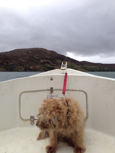


The Ferry Boat Dog

The Ferry Boat Dog, en-route across the kyle


On my way over with fellow passengers and another dog

On my way over with fellow passengers and another dog


The other side of the kyle

The other side of the kyle


I was slightly worried the dogs might have a disagreement but the voyage passed peacefully, and I had a chat with my fellow passengers – thanks for helping with my panniers, and for the encouragement!

Having disembarked I loaded everything back on to my bike I set off on the circa 11.5 mile ride to the Cape Wrath lighthouse and Ozone Cafe. I quickly lost sight of the minibus as it steamed off ahead, but didn’t envy the passengers with it bumping around all over the place; they needed padded shorts like mine for the journey! 

Entering the MOD firing range

Entering the MOD firing range


The road is in a pretty poor state but passable on my bike. There are quite a few hills so was hard going when you throw in the bumps too. I didn’t want to go too fast for fear of damaging my wheels or tyres. I passed several cyclists going the other way back to the ferry, who’d got the 09.30 boat. One of them had a puncture which he was mending – he was on lightweight continental tyres so not that surprising on the puncture front. I also passed through the MOD firing range, thankfully no naval bombardments were going on today, although it would have made for a more interesting blog chapter.

The road passes through moorland for the most part, with bridges crossing the occasional stream, a few herds of sheep and the occasional farmstead. Not many if any trees up here – probably too exposed, or they get eaten by the deer.

Road through moorland to Cape Wrath

Road through moorland to Cape Wrath


Looking back down the kyle

Looking back down the kyle


Exiting the firing range

Exiting the firing range


Lighthouse finally in sight

Lighthouse finally in sight


I finally made it to the lighthouse and Ozone Cafe after about an hour and 45 minutes’s ride. The minibus was still there having not set off on its return leg yet, so I said hi to a few people before it left. I met John who runs the Ozone Cafe, who pointed me in the best direction of somewhere to pitch my tent, down next to the high stone wall where I’d be sheltered from the wind. I pitched my tent then went back to the cafe for a cold beer, a welcome beverage after quite a tricky ride; it’s quite mentally tiring to be constantly on the look out for potentially wheel damaging or cyclist injury obstacles on the potholed road. John told me the council patch it up every summer but it’s getting worse, eroded by the harsh weather especially in the winter, not to mention the frequent minibus tours – must play havoc with the van suspension. John also said he could supply dinner for me which I quickly agreed to – salmon being a better option than pasta.

Tent set up in the lea of the wall

Tent set up in the lea of the wall


Two walkers arrived whilst I was enjoying a beer at the cafe, having trekked up from the bothy a few miles away. It turned out they had kayaked around from Sandwood Bay this morning, and were staying the night at the bothy. Iain, the older of the two, is attempting to kayak around the whole Scottish coastline, no mean feat, and had been joined by his son Angus for the week. As with me, but probably more so, they’re really effected by the wind, as well as the tides and currents, so it can be slow going some days and really quick others. Pretty extreme kayaking around the coast of scotland – I’ve seen how quickly the  tide can rip through some of the narrow channels, and the weather can change pretty quickly. Iain said the maximum he’s  travelled in one day is about 50km, pretty impressive in my book. You can check out his blog at http://www.coldwetwater.blogpost.co.uk

I spent a while chatting with them over a beer, good to swap stories. They’d kayaked into a few of the sea caves down below the cape, which you can only get to from the water, sounded amazing. It must be a completely different perspective from sea level. The sea bird colonies are also a lot more visible from down there; they’d seen hundreds of gannets – I still really want to see them fishing. Iain and Angus (McBride) left after an hour or so leaving me pretty much alone to walk around the cape and take a few photos, which I’ll include at the end of this post.

The area around the lighthouse is wonderful, a harsh environment to live in when the weather is bad, but beautiful on evenings such as this, with moorland, sheer cliffs, seabirds and grazing deer. On other days you might have seen a whale or dolphins off the coast, but I didn’t spot any today. I think this was the furthest point from home I’d get to on the UK mainland, but will have to check that, it certainly felt like the most remote.

The tranquility was at one point shattered by the barking of a pack of dogs, and a group of five enthusiastic springer spaniels careered around the corner of the lighthouse buildings to come and see me. They turned out to be search and rescue dogs that John keeps, and once having found me the barking stopped, with a few wet noses checking me out. They bark because that’s what they’re trained to do when they find someone, but they were very friendly.

I retreated to my tent for a bit and promptly feel asleep it was so peaceful, waking up about 18.00 in time for dinner. I popped back up to the cafe and dined on wild Atlantic salmon, with new potatoes, peas and carrots, with butter. Absolutely delicious. I chatted with John for a bit, who’d caught the salmon himself, it was much nicer than the farmed stuff which he is fairly critical of, the fish being full of chemicals. In the past he’s worked on a salmon farm, and talked to divers who’ve been underneath the salmon enclosures where there are piles of waste which nothing touches, sounds horrible. 

John confirmed it can get pretty fierce up here in the storms and high winds, but it’s a stunning spot, with shipping slowly cruising past on the horizon. Apparently you get naval ships moored up close by during exercises, and they often leave John some of their supplies at the end of their stay in the area. He’s kept busy all the time with maintenance and looking after visitors. The Ozone Cafe is effectively open 24 hours a day, all year, to cater for anyone that might turn up at any time. Hikers can arrive at any time of the night completing the Cape Wrath trail. John has been here 5 years, with visitor numbers gradually increasing. I hope more people visit but not too many as to spoil the feel of the place – I don’t think that will happen given its remote location.

The lighthouse, built by Robert Stevenson again, was constructed in 1826 post great demand after 3 ships were lost in one night alone on the treacherous coastline. The Stevensons built a total of 96 lighthouses around the coast of Scotland, a pretty amazing legacy, and also advised and built similar structures abroad, as far away as New Zealand and Japan.

A lighthouse is certainly needed at Cape Wrath, even though it’s unmanned now as so many are. John says he has to go and reboot the lighthouse computer for the Lighthouse Service frequently as it crashes, so sounds like it would benefit from a keeper still! It’s a shame there are less lighthouse keeps now. They provided a valuable service to the coastguard, keeping an eye out for people in trouble, and providing real time weather reports which were also invaluable. They also used to record details of the wildlife in the area, providing great information to naturalists. Unfortunately some of the lighthouse out buildings are in a bit of a state of poor repair now with no one around to upkeep them.

Cape Wrath is a apt name haven the location and weather that can hit the area. The name actually originates from the Norse words for turning point (area called Am Parth in Norse I think) as this is where the Norse ships turned East to go back home on their trading or being a Viking voyages.

The Ozone Cafe and Cape get quite a few visitors, either people who’ve come over on the ferry and minibus, hikers doing the Cape Wrath trail, or kayakers! It’s a must visit spot if you’re in the area, and had been on my list from day one so I was very glad to have made it, and that it wasn’t foggy. I felt quite exhilarated by the whole experience, and certainly slept well that night. If you’re cycling the road across to the lighthouse you’ll definitely need padded shorts though! Be warned there are no toilets at the moment, fine for me but could be tricky for some.

There was a cool poem on the wall of the cafe that I thought I’d include, written by Sir Walter Scott, one time commissioner of the Northern Lighthouses, in 1814.

Far in the bosom of the deep

O’er these wild shelves my wrath I keep

A ruddy gem of changeful light

Bound on the dusky brow of Night,

The Seaman bids my lustre hail,

And scorns to strike his timorous sail.

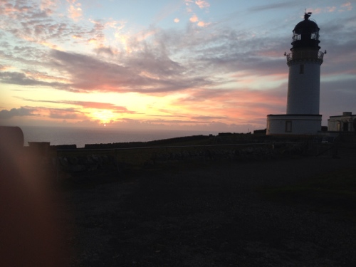
Cape Wrath Lighthouse and Ozone Cafe

Cape Wrath Lighthouse and Ozone Cafe

The Lighthouse

The Lighthouse


Cape Wrath foghorn

Cape Wrath foghorn

View from hilltop down to Lighthouse

View from hilltop down to Lighthouse

Another lighthouse shot

Another lighthouse shot

Cape Wrath - dramatic cliffs

Cape Wrath – dramatic cliffs

Cape Wrath - dramatic coastline

Cape Wrath – dramatic coastline

Cape Wrath - sun going down

Cape Wrath – sun going down

Cape Wrath - Red Deer coming joint me for the evening

Cape Wrath – Red Deer coming joint me for the evening

Cape Wrath - Swallow or House Martin?

Cape Wrath – Swallow or House Martin?

Cape Wrath - Deer silhoutetted

Cape Wrath – Deer silhouetted 

Cape Wrath - Sunset

Cape Wrath – Sunset

Cape Wrath - Sunset 2

Cape Wrath – Sunset 2

Cape Wrath - Lighthouse on

Cape Wrath – Lighthouse on

Cape Wrath - Spring spaniel patrol

Cape Wrath – Spring spaniel patrol

Ozone Cafe - wild salmon dinner

Ozone Cafe – wild salmon dinner

The Ozone Cafe

The Ozone Cafe

Too many pictures!

Too many pictures

Leg 30 – to Durness via Tongue

Onwards to the Cape.

30 May 2013

I was up and about in good time, to a bright day in Bettyhill. Over breakfast I met a couple of cycle tourers who’d gone to bed by the time I’d arrived last night, one Italian and one German, both doing tours around Scotland, and using Ortlieb panniers like me; only things suitable given the weather! They were both on their way to Orkney and enquired about the ferry times, so I gave them the brochure I still had.

I also met a Labrador dog named Max, he was very friendly and wanted to sniff everything, especially the Tiffin I was having for breakfast dessert; a new concept I’ve developed which I think works. I’m sure dessert for breakfast is totally acceptable.

View from my tent in Bettyhill

View from my tent in Bettyhill

I hit the road about 10.00 hoping to get along to Cape Wrath today, but that would depend on the weather and hills along the way. My route took me up round to Borgie, whereupon I took the minor road out to the coast and Skerray, cycling through some great countryside which is home or all sorts of flora and fauna, including Ospreys, but I didn’t see any. I did hear about 3 Cuckoos whilst cycling around the Skerray loop to Coldbackie. Apparently they are much more common in Scotland, their preferred nest to deposit their egg in being that of the Reed Warbler, which is also much more common up here. Think it’s the the Reed Warbler anyway, someone told me they’d seen it on Springwatch but I didn’t write it down at the time.

Beautiful day on the way to Tongue

Beautiful day on the way to Tongue


The long and winding road

The long and winding road

Skerray is a lovely looking village, small and with a thatched post office which must be a rarity. I cycled down to the harbour where you can see the island of Eilean Nan Ron, not inhabited by humans, but home to lots of seabirds. I still really want to see a Gannet colony but that might have to wait a bit, probably best seen from a boat anyway.

On route to Skerray

On route to Skerray


Skerray Harbour

Skerray Harbour


Skerray Harbour 2

Skerray Harbour 2

I made it around to Tongue by about 12.30, and decided to stop at the Hotel there for a lunch break. It was a great view out over the Kyle of Tongue, with the Rabbit Islands in the bay, and the bridge crossing about halfway down the Kyle I wouldn’t be taking. After chatting to a few tourists outside who were interested in what I was doing, and gave me lots of encouragement, I dined on poached smoked haddock and a toastie, with a pint of Belhaven Best to wash it down. The poached haddock felt like an extravagance but couldn’t resist it, I’ll just have to wild camp a bit more. The chocolate fudge cake was’t bad either, think I’m going to have to wean myself off pub food, but not today. I also had a FaceTime call with my parents, who were being visited by my brother, sister in law and their toddler son. It was great to talk to them all at once, thanks to the free wifi supplied by the hotel. The wonders of modern technology.

Roadside break before Tongue

Roadside break before Tongue – Rabbit Islands in background


Me with hair sticking out of helmet as usual

Me with hair sticking out of helmet as usual


View from Tongue, sea fog rolling in

View from Tongue, sea fog rolling in


View from hotel - the other way

View from hotel – the other way

I spent a couple of hours at the hotel catching up on emails, a bit of social networking, and my blog. A friend from Norwich had written an acoustic song which he’d posted in honour of my tour – nice touch and great tune, thanks Bill, will have to post up the link when I get back to an Internet connection somewhere. So a bit of a longer break than initially planned but worthwhile, even if I could see the sea fog rolling down the kyle as I rode off.

Road around Kyle of Tongue

Road around Kyle of Tongue


The road around the kyle reminded of Greek countryside, which was a bit weird – scrubby trees looked a bit like olive groves.

Road around Kyle of Tongue 2

Road around Kyle of Tongue 2


Road around Kyle of Tongue 3

Road around Kyle of Tongue 3


Road around Kyle of Tongue 4 - bridge and haar rolling in

Road around Kyle of Tongue 4 – bridge and haar rolling in


Ignoring the bridge I cycled all the way around the kyle, through some lovely scenery again, before getting back to the A838 and turning west. It looked as if there weren’t going to be many more level bits on this leg though, which was confirmed by the long climb from the other side of the bridge, up through the moorland, which lasted about 3 miles. I stopped once just before the top to answer a phone call from an unknown number. It turned out to be Ed from the BBC film crew the other day saying thank you for meeting up and doing the interview. Unexpected and nice to get a call to say thank you; he’s going to send copy of the programme too so I’ll definitely get to see it. Ed recommended the Hebrides so think I’m going to have to get across for a day or two from Ullapool for a cycle about; think I’ll have time but might have to put in a few longer legs to make up for it down the line – will wait until it gets a bit flatter.

View from top of hill back towards Kyle of Tongue

View from top of hill back towards Kyle of Tongue


Moorland and whispy clouds

Moorland and whispy clouds


Clear blue lochs abounded

Clear blue lochs abounded

Cresting the hill I coasted down the long descent to Loch Hope, letting my aching legs recover, and passing through patches of sea fog that were getting thicker. I’d seen it flowing down the Kyle of Tongue earlier and had been above it when going over hill. Then it was another long climb up Ben Anaboll, before descending into thicker sea fog (Haar) down to Loch Eriboll.

Bridge at Loch Hope - fog rolling in

Bridge at Loch Hope – fog rolling in


Pedalling around Loch Eriboll I could see more fog rolling in, blown by the northerly wind. It was moving quickly and was quite dramatic – was getting a little concerned it might get too thick to safely cycle in. Even so I still had periods of bright sunshine and the loch looked beautiful. It’s a tranquil setting with lambs in the fields, the odd red deer, or group thereof, and the occasional farmstead. Don’t think I’ve passed over quite as many cattle grids on an A-road before. 

In the sunshine for the time being

In the sunshine for the time being – Loch Eriboll


Loch Eriboll - beautiful view

Loch Eriboll – beautiful view


Loch Eriboll - salmon farm I think

Loch Eriboll – salmon farm I think


End of the Loch - nice photo

End of the Loch – nice photo


I made it around the end and pedalled up the other side straight into the fog and wind. This made the temperature drop off quite a bit, so I stopped to eat some bananas and put another layer on. The fog unfortunately had no effect on the undulating terrain which continued to tire my legs out, even if I couldn’t see the hills.

The Haar drawing in

The Haar drawing in


I started to remember the film called The Fog, and was hoping their weren’t any zombie ghost pirates in the haar. As it was there was only occasional car, and plenty of stupid sheep standing in the road as usual. It’s pretty sparsely populated around the loch with only the occasional farm, B&B, and what looked like a salmon farm. As usual all the car drivers were very careful and gave me lots of space; they really are so much better around cyclist up here. Passed quite a lot more motorbike tourers today too.

One other observation about the landscape – the underlying rock changed to limestone, making the land a lot more fertile and greener – there was a sign that told me about this before you think I’m a geologist. The coastline has had lots of useful signs with interesting facts along the way.

Post Loch Eriboll and another ascent I cycled around the coast in the fog to Smoo. The road probably looks quite dramatic in the the light of day without the fog, who knows. I could hear the waves crashing against the shoreline quite a long way below but couldn’t see them. Stuck my head torch on for good measure, although the visibility on the road actually wasn’t too bad. Pretty exciting ride along what looked like some sheer sided cliffs, but couldn’t really tell.

I stopped at Smoo to look at Smoo Cave, climbing down the steep path to the cove. The origin of Smoo is the Norse word for cave I think, and this one has been used for several thousand years by different groups of people. First there were the Neolithic hunter gatherers, whose midden heaps of hells are still in evidence, then on to the Celts, not sure if the Picts stretched up this far, the Norsemen certainly did giving the place it’s name. More recently it’s been used by fishermen, but looks like it’s always been used for shelter, homes, workshops, or storage. You can go on a boat tour to get deeper inside, but these had stopped by the time I arrived. I still managed to have a good wander about and see a waterfall cascading down into the cave; got some good pics.

Smoo Cave Cove

Smoo Cave Cove


Smoo Cave 1

Smoo Cave 1


Smoo Cave 2

Smoo Cave 2


Smoo Cave 3

Smoo Cave 3 – waterfall


Smoo Cave 4

Smoo Cave 4 – me at waterfall


They have to be quite careful on the tours as the water level can rise quite quickly, a result of rainfall which can have occurred miles away – the river which runs out into the sea here, and created the cave network, has a large catchment area. The last thing you want is a load of trapped tourists, tricky to rescue and not good for the local tourism industry!

I arrived in Durness and found a large campsite, costing £6.75, and right next door to a pub/restaurant which was a bit of a bonus considering I was a bit chilly by now. I had abandoned plans to get all the way to the Cape today long ago – the weather was too adverse and the ferry would have stopped by now anyway. After de-rigging the bike and setting up my tent I had a quick shower to warm up. There were a lot of motorbike tourers in, most from Germany by the looks of it and I had to stop myself from whistling Deutschland Deutschland repeatedly. There were also lots of camper vans in from all over the place – I spotted UK, Germany, Belgium, and the Netherlands. It looks like Cape Wrath is a popular destination for many; I thought it much more worthwhile a place to visit than John o’ Groats and I hadn’t even visited it yet.

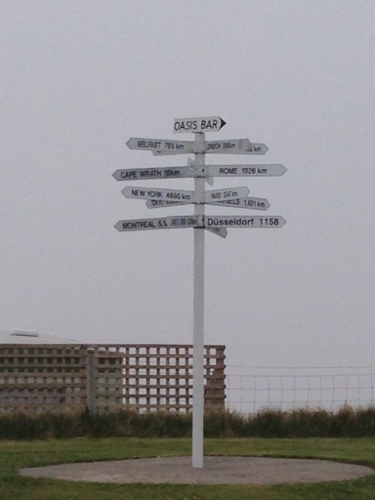
Another signpost to various destinations

Another signpost to various destinations

The campsite has a campers kitchen which is pretty good, equipped with gas burners you can use free of charge. There were some Germans cooking up what smelt like goulash in there – smelt very good. They had Wurst too, I was getting hungrier by the minute. I chatted to one of them for bit, not sure what his name was but we’ll call him Klaus for the sake of argument. Klaus had ridden up with his posse earlier today, taking a route through the centre rather than along the coast. Sounded like a nice ride and must be good fun with a large group of bikers. I’m tempted to go motorbike touring myself sometime, in Europe has always been an ambition, but I’ll need to save up again, and pass my test etc etc. Still prefer my bike and moving under my own power at present. Less noisy, polluting, and you see more, even if it does take longer.

Post chatting to Klaus and then the campsite owner (she agreed sheep are indeed stupid animals, with a death wish on the roads), I retired to the pub next door and consumed their mix grill, with new potatoes as I was getting sick of chips. Not a bad mixed grill, but not the best black pudding I’ve ever eaten. I decided to have an earlyish night in preparation for Cape Wrath tomorrow – it seemed fitting to be going there exactly one month after leaving Norwich.

I’ll finish with a general health update – of me and my bike:

 – Bike running well but might have to adjust the gears a bit as they skip around sometimes. New wheel seems sound. Could do with a clean at some point! Front right pannier fix still holding admirably.

 – When I started this tour I was about 12 stone, and whilst I don’t have access to scales I reckon I’ve lost weight. My waistline has shrunk a bit, however I’ll have put weight on in my legs which are much stronger, and probably my arms and shoulders which also do a fair amount of work on hill climbs. I’ll try and find some scales soon.

 – No chafing to report, which may be down to frequent use of chamois cream, and the fact it’s been too cold to sweat much. I also sometimes use Emu oil on tired and aching muscles at the end of a hard days ride, which seems to help. Probably need to do more leg stretches as usual, as my muscles sometimes feel a bit stiff and tight in the morning, before they loosen up with some gentler spinning to start off with.

– Shins still pretty battle scarred from pedal hits and scrapes, takes ages to heal properly.

 – No knee problems to report, and haven’t needed to use the Biofreeze Gel for ages, even if it does smell nice. Posterior also surviving long days in the saddle, thanks to padded shorts and just getting conditioned to it.

 –  Tan lines looking a bit dodgy on the legs due to my modified cycling bib. I cut the knees out to stop them pulling my kneecaps over slightly, which was causing pain after long rides and lots of revolutions. It’s because I have a slight pronation and the physio advised I try this; cleared up the anterior knee pain a treat. Face pretty tanned, or should that be weathered. Arms not tanned as I’ve been wearing long sleeves. Sun needs to come out more often really.

 – The cold weather can get a little draining, especially if it’s windy too which it has been on several occasions, damned headwinds. I’ve been left feeling a bit frazzled sometimes. Apparently it has been the coldest spring for years, something I can attest to. Not had too much rain recently. Would be really good to have a few warm days, with no wind, to raise morale. Would also make camping and cooking in the evenings easier, and thus be less tempting to retreat to a pub which gets expensive – I have a generous but still limited budget.

– Emotionally fine, even if I do have a lot of time to think which inevitably means my thoughts turning to Lu – good thoughts and memories as well as sadder ones. I haven’t been lonely at all as always seem to be meeting people to have a chat to, and generally have good mobile reception on Vodafone so get texts and emails, and can keep in touch with friends and family.

– I do need to wash some clothes again pretty soon. Running out of outfit changes, and whilst it’s easy to wash socks regularly, cycling bibs and tops take more effort. No-one has commented on me smelling bad…yet.