Although I’ve completed my tour now I’ve still got around 20 blog posts to write up from it, so if you’re enjoying it or finding it useful for planning your own tour please consider making a donation to the Big C, either directly or via my charity page:
http://www.virginmoneygiving.com/james
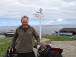
The following was one of the toughest days of the tour so far, just down to the conditions and hills, but satisfying to cover around 100 miles, and good to meet a few friendly folk.
30 June 2013
I was up in good time, keen to cover a good distance and get ahead of the game in my quest to get to Latitude by 18 July. Unfortunately it was another overcast and windy day, the prevailing south westerly having strengthened overnight which was going to prove tough. Why couldn’t there just be no wind for a day or two? Perhaps I’d angered those Norse gods again.
Post a check over the Ridgeback I received a bacon roll from my next door neighbours, a bonus I wasn’t going to turn down. It was their last day camping before driving back to the Midlands so they had food to use up, and I was perfectly placed to oblige in ensuring nothing went to waste! Perhaps some of those Norse gods were in fact on my side.
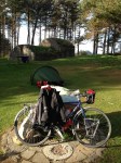
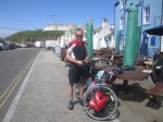
Suitably loaded with calories, and with my bike loaded with luggage, I was on the road by 09.30 pedalling off towards Harlech.

Bike loaded and read for another day’s riding
Harlech has an impressive castle, overlooking Tremadog Bay. Unsurprisingly it’s another castle that was originally built by Edward I, and was also the stronghold of Henry Tudor. The Welsh ruler Owain Glyndwr captured the castle, along with large parts of Wales during the revolt against the English which started in 1400, and lasted through to 1409 when he disappeared; the English never caught him though.

Harlech Castle 1
The castle lies atop a crag, about a half a mile from the sea, although when it was first built the coastline was a lot closer.

Harlech Castle 2
Pedalling on down the A496 I had the song ‘Men of Harlech’ going around my head for a good hour. It’s a good stirring tune, perfect for a grey day, and I was soon humming it quite loudly. I like it when they sing it in the film Zulu. The road follows the coast down to Barmouth, a once popular tourist destination, taking in several quite big hills on the way.

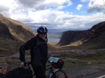
Hills above Harlech, looking back North toward the Lleyn Peninsula

A random accidental picture of my leg, note tan line.
I made it to Barmouth in good time, where the Great Western used to deliver droves of holiday makers for their once a year seaside break from up north. By the looks of it tourists are still visiting in significant numbers.
 Mawddach")
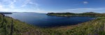
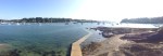
River (Afon) Mawddach, Barmouth
I was able to take the toll bridge over the Afon Mawddach, which is open to pedestrians and cyclists and saved me a long trek inland. As with the previous day’s toll bridge there was no-one to pay a toll to, so I happily trundled over the somewhat bumpy wooden boards across the river.

Toll bridge looking back towards Barmouth
There are rail tracks across the bridge, and I believe a train still runs across it, but it didn’t make an appearance whilst I was there.

Toll bridge looking towards opposite shore from Barmouth
On the other side I continued around to Rhoslefain, getting a bit blasted by the wind. I felt a bit better about it as at least there were more cyclists out today, getting equally blasted and thus sharing the pain. Greetings and mutterings about the weather were exchanged with several, and I was joined by one near Bryncrug. Eddy stayed with me until Tywyn, which was really nice as I was able to slipstream him slightly, taking the edge off the wind. I hadn’t ridden with anyone in a while and it was good to chat as we pedalled along. I think he’d recognised I was struggling slightly with my heavier load, and I certainly made better time for the next stretch.
We both stopped at a cafe in Tywyn, in need of sustenance. I opted for the full Sunday roast and Rhubard crumble, Eddy for just the crumble. I figured my bike was a lot heavier so I could justify the extra calories, plus I still had a long way to go. Eddy bought me a coffee which was nice, and it was good to chat over lunch with a fellow cyclist. Having had quite a hard morning with the weather and hills, riding with someone else, followed by a very decent lunch break, was a great morale boost. Eddy is from Worcester and regularly comes up to the Welsh coast to cycle. He’s a member of a road cycling club, but also gets in some mountain biking; sometimes it’s a case of never the twain will meet however I think it’s good to get in a bit of both. Speeding downhill on a mountain bike, almost expecting to be thrown off at some point, can be very exhilarating. It was good to share experiences, the good, bad and ugly, and my theory on hills being honest and the wind dishonest.
Thanks for the drink and for the slipstreaming Eddy, much appreciated, and good luck on your Lejog!
Eddy had to leave so I finished dessert, which had an ample amount of custard, and called my brother to say hello before getting going again.
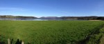
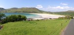
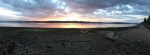
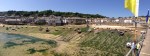
It didn’t take me long to get to Aberdyfi, or Aberdovey, where the windsurfers were out in force, along with kite surfers a bit further up the coast. The beach was really busy and it was perfect conditions if you were using the wind to power your transit, rather than it being a pain in the proverbial.

Aberdyfi beach panorama
According to my brother, a keen windsurfer himself now he doesn’t spend most of the time in the sea rather than on the board, the coast around here is very popular with windsurfers. I could see why, and there seemed to be a competition or at least gathering of surfers going on.

Aberdyfi windsurfers 1
Several of them were ripping along, with good planes going, and some quick carve gybes that if I’d attempted would have resulted in being catapulted off the front of the board, and the sale mast landing on my head.

Boards on the beach

Aberdyfi windsurfers 2
I’m quite tempted to have a go again myself when I get back to Norfolk, perhaps going up to Hunstanton with Will (brother) at some point, although it’s been a few years so I’ll probably spend most of my time in the water.

Flags flying in Aberdyfi
Leaving the windsurfers behind there followed a long stint inland alongside the Afon Dyfi (River Dovey), which doesn’t have a handy toll bridge over it. It was nice to have a bit of a tailwind down to Machynlleth, but then I had to turn back south west towards Aberystwyth. I passed an Osprey centre just before Furnace, but couldn’t spot any of these great birds of prey as I rode along, through quite a bit of forest alongside the river.
There’s an old iron smelting site in Furnace, from whence the town’s name is derived. The building has a great waterwheel, and was obviously quite an important industrial spot from the 1750’s through to the 19th century.

Waterfall next to Furnace

Iron smelting building and waterwheel

Waterfall and enthusiastic springer spaniels
At Tre’r-Ddol I turned on to the B4353 to follow the coast, over some flatter terrain to Borth, although the lack of hills meant it was more exposed and I was getting knocked about by the wind again. Borth was a childhood holiday spot for my Mum, which was just a smattering of years ago of course, and she remembers it being just as windy when she used to visit.

A blustery day in Borth – big hill coming up

Borth beach – not too popular today

Borth beach – looking south
Out of Borth I had to tackle a very long and very steep hill climb, with a few 25% sections that really pushed the limits of my ascending ability. I had to stop to rest a couple of times, but made it up the hill without having to push which was pretty satisfying. I don’t think I could have done that when I’d started a couple of months back.
Top of the hill looking back towards Borth
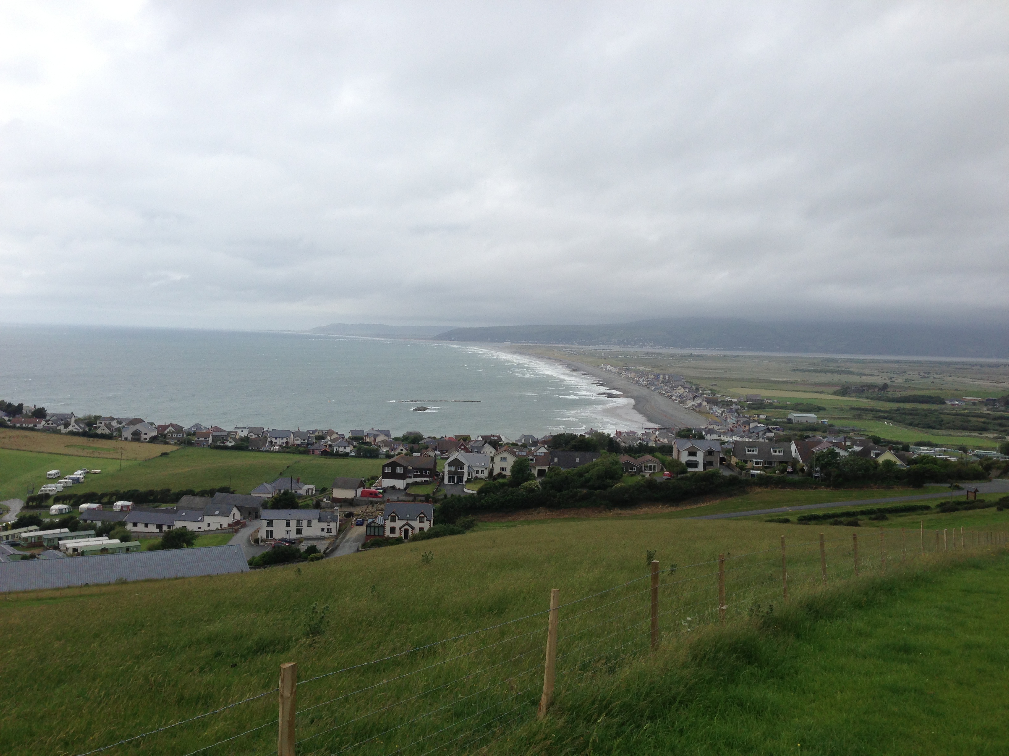
The road continued to be challenging as I pedalled over to Aberystwyth, with lots of long, steep and continuous hills. Any cyclist up for a challenge should consider the B4572 from Borth to Aberystwyth, very satisfying once you’ve made it. Do it on a fully loaded touring bike for the extra challenge. A random passing car even gave me a cheer on the final ascent before the long downhill section into town, all encouragement was gratefully received.
I had a quick cycle around Aberystwyth, considered stopping for a quick pub break, but didn’t find anywhere inspiring so decided to push on.

Aberystwyth seafront

Aberystwyth University building

Aberystwyth Harbour – choppy sea
Cardigan Castle is another one built by Edward I, who replaced the original Norman built fortress. The castle was razed by parliamentary forces during the English Civil War, so is now mostly in ruins.

Aberystwyth Castle
With lots of miles to do but doubtful of reaching Cardigan, my original target for the day, I rode south from Aberystwyth, joining the A487. The next set of hills weren’t small, so I settled into a slow but steady pace, taking them one after the other and refusing to stop for a rest. Up, then down, and repeat. The constant hills were stopping me from getting into any real rhythm, and with the day drawing on I was beginning to think I’d be wild camping if I didn’t stumble upon a campsite. I stopped at a handy garage to buy a few snacks to keep me going – you can never go far wrong with an emergency pork pie break, bag of crisps to replace salt, and perhaps a bottle of chocolate milk.
I eventually made it to Aberaeron, pushing on past at least two campsites whilst I still had a few hours of daylight left. Despite being tired I was keen to get a few more miles done. Sometimes I just can’t decide when to stop, and defer making a decision for ‘just a few more miles’ to see what’s around the next corner.
The big hills continued as I pedalled to Llanarth, where I turned off the main road on to the B4342 to New Quay, not to be confused with the Newquay down in Cornwall. Earlier I’d checked the Internet on my phone and seen there were lots of campsites around New Quay, so thought it would be a good place to stop. Unfortunately despite being given directions by a helpful local, and following what I thought was a signpost to a campsite, I couldn’t find one, and didn’t have enough signal on my phone to check the web again. I have absolutely no doubt I passed with a few hundred metres of several, but one of my other flaws when cycling is I don’t like to turn around and retrace my route, so I just kept on going out of New Quay, tackling more hills, but enjoying the fine evening. Oh, and more snacks were duly consumed to keep up energy levels.

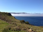
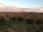
Verdant Welsh Countryside near Llangrannog
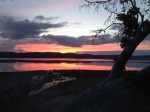
With the sun starting to get seriously low I followed the signposts to Llangrannog, sure I’d find a campsite somewhere. I didn’t, the road just continued to go up and down, but was very pretty. I passed through Nanternis, continuing to ride parallel to the coast as much as possible, and after wiggling around a bit made it to Llangrannog.

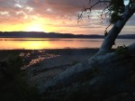
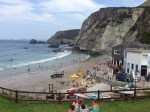
Llangrannog Beach
According to local legend one of the rocks sticking up in the bay is actually the tooth from a giant named Bica, who spat it out when he got toothache.

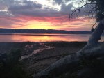
Llangrannog panorama
The village and beach looked beautiful with the sun going down, and there’s a nice looking pub, but no campsite I could find.

Llangrannog pub
I had to cycle up another steep hill to get out of the Llangrannog, something that was definitely becoming a feature of this part of the Wales with the road following the coastline and dipping down into all the valleys and coves.

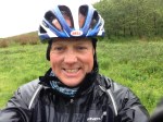
Me looking a bit wild in Llangrannog

Llangrannog – silhouette of the statue of St Caranog
The statue definitely has a nice view.

St Caranog, Llangrannog

Llangrannog looking North

Llangrannog Village
I rode down country lanes continuing to look for a place to camp (on reflection I should have pitched up next to the saint). It was still light, vaguely, but very dark where the trees formed tunnels over the road, and I had to get my lights out. The road continued to be very pretty, but I was starting to get very tired due to the incessant hills, and I was passing lots of farms, with lots of sheep who were looking at me balefully as usual.
On one particularly wriggly bit of road I rounded a corner to come face-to-face with a frisky bullock. This wasn’t the first annoyed bovine I’d met on this tour, but it was definitely more aggressive than it’s Scottish cousin, having become a bit panicked by a car horn. It’s fine beeping your car horn to try and encourage a cow off the road when you’re safely ensconced within a metal body, however I didn’t have that luxury on my bike. Thankfully after about a minute of it pacing about, and me slowly backing off, the farmer turned up with a couple of helpers. Two of them did have to jump back into their Landrover at one point when the bullock charged them, but eventually they got it back into a field and I pedalled on unmolested.
My close encounters with Welsh farm animals continued as I rode through another farm, where three dogs bounded out to greet me, barking manically. I was a bit nervous they were going to bite me or my panniers, but they calmed down once I said hello and left me alone thankfully.
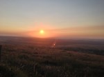
Finally, with the light almost gone and post more hills, I found a campsite somewhere between Morfa and Penbryn, near Sarnau, although I wasn’t really sure where I was by this stage, I just knew the coast wasn’t that far away. I arrived about 22.15 and checked in at the farmhouse, the farmer and his son looking a little surprised to have such a late visitor turn up on a bike. It cost me £12 but they were friendly, and a warm shower was most welcome after the hard day.
That was one of, if not the hardest day of the tour so far, due to the bad weather throughout most of it, and leg/lung busting hills. I was however very satisfied to have covered nearly dead on 100 miles, even if it had taken me about 12.5 hours; my average speed had dropped somewhat. I was a bit concerned as to what the state of my legs would be in the morning, and my morale had taken a bit of a beating at times, but thanks to lunch with Eddy, a phone call to my brother, and some nice Welsh countryside I was feeling alright again.
I got my tent up as darkness fell, and it wasn’t long before I was soundly asleep.