Tag Archives: Wick

Leg 26 – to John o’ Groats and Thurso

26 May 2013

I was on the road by 09.30, feeling enthused about making it up to John o’ Groats and and seeing the North coast of Scotland. Might even bump into a few tourers starting their Jogles, or competing their Lejogs! I had a quick cycle around Wick before leaving. It was pretty dead compared with the previous evening, not many people having surfaced as yet, especially of the younger generation. Unfortunately didn’t find any cafes open for a second breakfast opportunity.

Wick campsite

Wick campsite – weather looking promising


Wick harbour - weather getting less promising

Wick harbour – weather getting less promising


Waterfront nightclub, Wick

Waterfront nightclub, Not dissimilar looking from its namesake in Norwich

From Wick I cycled north under grey skies, and into a mild headwind making it chilly. The weather seems very changeable at the moment, there having been rain overnight, something you can hear very clearly in a tent. Think there must be a few weather fronts moving through, with the low pressure system that’s been sitting off the north coast finally moving.

I took the A99 up around Sinclair Bay, through Keiss and Freswick, and past Skirza, the latter two town names being Viking in origin. Think the Norwegians still ruled this area, at least loosely, until the 14th or 15th century. I’d read about how one of the last Viking adventurers had one of his strongholds around here but I couldn’t find it. Will have to look him up again. Going back to my Pictish topic of yesterday their must be loads of different bloodlines mingled up here, from Celt, Pict, and Viking, to more recent migrations. I love a bit of Viking history, having read Bernard Cornwall’s Uhtred books in which they feature. Hoping to get to Orkney where they’ll be more on them.

The road was relatively quiet, with more motorbike tourers out than anyone else, but I passed a few cyclists going the other way and waved. The landscape is mostly moor and farmland, and remained fairly consistent all the way to the north coast. I thought I could see evidence of peat cutting, which no doubt provided a great source of fuel in the past. On the subject of fuel sources I’ve seen quite a few coal trucks about in Scotland, so they must burn it in boilers still up here. I can’t remember seeing a coal truck down south for years.

Continuing on I passed quite a few older buildings in a dilapidated state, or ruins, providing a stark contrast to the newer homes built more recently. I thought the older ones looked more in keeping with the landscape, but would be a tad drafty!
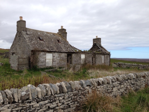
Old farmsteads

Old farmsteads – passed quite a few like this over the last few days


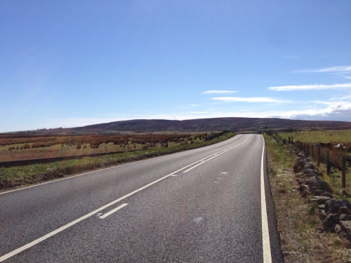
The road North

The road North


Gorse in full bloom

Gorse in full bloom – stark contrast to the grey day


I pedalled on to John o’ Groats, but just before the Lejog finish line I turned right and cycled to Duncansby Head, the true most north easterly point on the UK mainland. Coming over the rise before John o’ Groats had been quite an emotional experience, even though I’m not doing a Lands End to John o’ Groats ride. I’d still been 26 days on the road and covered well over 1500 miles, and seeing the North coast with Stroma and Orkney in the background, with the sun coming out, caught me off guard.

Duncansby Head was worth a visit, there being a big seabird colony in the stacks nearby. There’s a lighthouse there built by Robert Stevenson, father of Robert Louis Stevenson of Treasure Island fame. He built quite a few of the lighthouses on this coast, including the one at Dunnet Head which I visited later. There must be a lot of lot of lighthouses on this coast, it being a little treacherous to shipping.

Duncansby Head

Duncansby Head 


Duncansby Head lighthouse

Duncansby Head lighthouse

Apparently it’s a little short for a lighthouse, but makes up for it by being quite high up.

I cycled  back to John o’ Groats and down to the centre by the harbour, where the famous sign post is. Took some photos then had lunch in one of the nearby cafes – wanted pizza but they’d run out of bases so settled for a bacon, tomato and mozzarella panini, equally as good if not quite as carb heavy. It was great looking out across across the Pentland Firth to the isles, and I met up with Dan and Dave who’d just finished their Lejog, covering 980 miles – respect to anyone who’s completed the end-to-end ride. They’ve got a blog which is worth a read for anyone considering doing the same – http://www.2blokes2bikes2far.info

John o' Groats Harbour

John o’ Groats Harbour


The sign post, with a lobster

The sign post, with a lobster if you look hard, although he is red


Me at signpost 1

JoG – Me at signpost 1


JoG - Me at signpost 2

JoG – Me at signpost 2 – thanks for taking the photo Dan/Dave


The Pentland Firth and seas around John o’ Groats, Stroma and Orkney are somewhat notorious, with tidal flows ripping through at up to 10 knots at times. The locals from Stroma used to guide ships through, however the island is now deserted and being reclaimed by nature, the last family having left in the 1960’s. At its height there were only about 360 people living there, earning a living primarily off fishing and as shipping guides. The fishing stopped when their main catch became depleted and too far to sail to, probably as a result of larger commercial fishing operations, a familiar story.

Isle of Stroma 1

Isle of Stroma 1


Isle of Stroma 2

Isle of Stroma 2


Bidding John o’ Groats farewell, realising this was nowhere near the end of my journey, I cycled west along the coast to Dunnet Head, via Mey and its castle, Scarsferry and Brough, through lovely countryside, although the sea does look pretty challenging to navigate through – rocks and rip tides – wonder if Will Copestake will be kayaking this bit of the coast. Check out his blog – http://willcopestakemedia.com/ , really interesting challenge he’s currently undertaking, affected by high winds like me.

Mey Castle

Mey Castle


Some stark panoramas

Some stark panoramas


Dunnet Head is the most northerly point on the UK mainland, and from it I had a clear view across to Orkney and the entrance to Scapa Flow, west to Cape Wrath, and back east to Duncansby Head. It was a bit of a climb to get up to it, but worth it. In World War 2 there used to be a lot of servicemen stationed up and around the head, keeping an eye on activity around Scapa Flow, the main British naval base which was under threat from bombing raids and other enemy activity. It must have been a challenging place to work when the weather turned nasty; there are still lots of old concrete buildings around where they used to live and keep watch.

Dunnet Head

Dunnet Head


Cliffs at Dunnet Head

Cliffs at Dunnet Head


Looking west towards Cape Wrath

Looking west towards Cape Wrath, where I’d be in a few days, touch wood


Dunnet Head, looking towards Orkney

Dunnet Head, looking towards Orkney


From Dunnet Head I rode along to Thurso, with a bit of a tailwind which was a nice change. I passed quite a few cyclists going the other way and having a considerably harder job of it u- gave them a wave. I realise I was now in effect doing a Jogle (John o’ Groats to Lands End), albeit via a somewhat convoluted route via Wales etc.

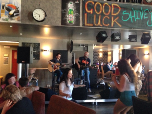
I cycled over the bridge into Thurso, and had a quick tour around, spotting a promising bar where I stopped for a pint and a meal – chilli burger. There was a live band on, two acoustic guitars who were excellent, doing a lot of old classic numbers some of which I can even play – Hotel California, Every Rose has its Thorn, Behind Blue Eyes, amongst others.  Great bank holiday atmosphere and would recommend the Y-not Bar, definitely rock and roll.

Bridge at Thurso
Bridge at Thurso


Y-Not Bar

Y-Not Bar – great band and atmosphere

Leaving a little later than anticipated I found the campsite just outside Thurso and pitched up, it’s right on the coast with some great views. Also ideal for getting the ferry the next day across to Orkney, which I intended to do as a side trek. A little bit expensive though at £11.

Thurso Campsite 1

Thurso Campsite 1


Thurso Campsite 2

Thurso Campsite 2


Thurso Campsite 3

Thurso Campsite 3


Thurso campsite - sunset

Thurso campsite – sunset

I’d also been in touch with Mark Beaumont over Twitter during the evening, and we’d arranged to meet up tomorrow morning in the town for a chat and maybe some filming, more on that tomorrow. Really looking forward to Orkney and its scenery, archaeology, and people, south easterly wind getting brisker though!

Leg 25 – to Wick

Hills, lots of hills.

25 May 2013

Post a good night’s sleep I woke up to a bright morning, and was on the road by 10.00 post a shower and shave. Remembered to put some sun cream on for a change! Feeling fresh I had a quick cycle around Dornoch, taking in the old square and market place, once the centre of commerce for the area, with several big fares held throughout the year; no doubt earning the Sutherlands a pretty penny. There was an old stone slab in the market place, one of only a few still in existence in Scotland, that was used to accurately measure out lengths of plaid/cloth/tartan.

Dornoch Market Place and Cemetery

Dornoch Market Place and Cemetery, plus cloth measuring slab


Merchants and Money - history lesson

Merchants and Money – history lesson


The markets, or ‘Mercats’, apparently went onto decline in the early 19th century.

From Dornoch I rode up to and around Loch Fleet, passing seals basking out in the sunshine on the mudflats. Not sure if they were Common or Grey seals, in fact I didn’t know what they were at all at first as they weren’t moving. Then the incoming tide started to submerge their basking spot and they all decided it was time to find a new spot, en masse, was quite a sight to see them all shuffling/swimming off. Some were quicker than others, obviously wanting to reserve the best spot with their beach towels. Also saw a Grey Heron fishing just on from the seals, he lunged down from a motionless hunting poise and his beak came back complete with a small meal, must have been second breakfast time; I was starting to get hungry again. Saw the usual masses of Oystercatchers.

Castle on shores of Loch Fleet

Castle on shores of Loch Fleet


Loch Fleet 1

Loch Fleet 1


Loch Fleet 2

Loch Fleet 2 – Seals


Loch Fleet 3

Loch Fleet 3 – Heron


I could have stopped every 50 yards for another photo of something interesting but thought I’d better get on, and made haste around to Golspie. I passed a few cyclists going the other way, including one tourer with whom waves were exchanged. 

Loch at Loch Fleet

Loch at Loch Fleet


Mystery statue just outside Golspie

Mystery statue just outside Golspie

I stopped in Golspie at a promising looking cafe called Poppy’s, and proceeded to consume their most excellent full Scottish breakfast, complete with black pudding, bacon, beans, egg, potato pancake thing, toast, mushrooms etc. I should have taken a photo of it but forgot in my haste to get stuck in, truly delicious – best second breakfast stop of the tour so far. Chatting to the owner I discovered the tourer I’d waved to earlier had been James Ketchell, on his way from John O’Groats to Land’s End (Jogle) in preparation for his round the world cycle starting in June. Check out his website – http://www.jamesketchell.net – he’s done a few great challenges such as rowing across the Atlantic. He’d stopped at the cafe too and had partaken of the same breakfast just 30 minutes previous. Anyway I heartily recommend Poppy’s Cafe to any hungry tourers passing through Golspie; you’ll need the energy for the next bit if you’re going north!

Leaving Golspie I pedalled on to Brora, through lovely countryside along the coastline, with only moderate hills at present. The gorse is really out in bloom at the moment, and not too much traffic on the A9 which I’d been nervous about, considering the bank holiday weekend. I stopped briefly in Brora to buy more bananas.

Post Golspie - lovely coastline

Post Golspie – lovely coastline


Post Golspie - lovely coastline 2

Post Golspie – lovely coastline 2


At Helmsdale things changed, with the terrain starting to grow more challenging. A long ascent got my legs going, followerd by lots of ups and downs through moorland and forest. The hills got really big again around Berriedale, steep and lengthy, leaving my legs somewhat burning by the time I reached the top only find to the scene repeated. I managed to make it all the way through this section without stopping, albeit in a very low gear, which I was pretty chuffed about; don’t think I could have done at a few weeks ago, on a bike this heavy. I really must deal with my squeaky pedal though as getting a bit irritating.

Hills around Berriedale

Hills around Berriedale – great scenery again


I rode on to Dunbeath where I stopped for a food break, raiding my panniers for calories to recharge on. A light north wind had started up which made the going a bit tougher, despite the hills getting milder. I pedalled on zoning out slightly, thinking about books again, as well as possible future plans; more expeditions – although I must finish this one first, opening a cafe/pub with a cycling theme somewhere – offering guaranteed high carb meals, 1000 calories minimum!

During the course of the day I passed several groups of motorbike tourers, who I kind of envied whilst going up the steeper hills. I still rather be riding under my own power though, less noisy and more environmentally friendly, reckon I see more to. I saw a group of buzzards circling overhead, riding the thermals, and wondered if they were waiting for me to expire on one of the steeper hill sections. Do they get eagles up this coast? I know they do on the west coast but not sure here, it would be great to see a Golden Eagle and a Sea Eagle.

Also passed a few abandoned villages today, in ruins. One was labelled as a clearance settlement, which tended to grow up along the coastline post the evictions in the 18th century I think, when landowners wanted to clear out tenants in favour of sheep farming. Not a popular move which displaced thousands from the more sheltered and fertile inland glens. Must have been a very hard and exposed life up here on the coast. Reminded me of a song by the band Goats don’t Shave which I used to play years ago – The Evictions I think it was called, will have to dig it out when I get home.

I continued on to Latheronwheel and Lybster under clear skies, but the terrain just seemed to keep repeating itself with more farms, livestock, and ups and downs through moorland. I passed a few highland cattle on which I heard a theory from my godfather and his wife. They think they are placed at strategic points by the Scottish Tourist board, and must complain about getting put in the same spot each year!

Terrain on repeat

Terrain on repeat


Endless road to Wick

Endless road to Wick


Must carry on!

Must carry on


I was beginning to think the road was never going to end by the time I reached Thrumski, with only few miles to go to get to Wick. Interestingly I don’t remember passing any golf courses today, maybe they’ve finally petered out.

I made it too Wick about 18.30, after another great but leg straining day, covering about 65 miles. I camped up about half a mile from the town centre at a nice sheltered site, with easy access to the centre via a path alongside the river. Decided to go into town to eat as a reward for today’s efforts, plus I couldn’t face pasta again quite so soon. Ended up at the local Weatherspoons which was cheap and cheerful, with a huge plate of curry and a couple of ales – Belhaven Best again. They also had free wifi and I was able to recharge my phone and iPad which was handy. Aside from that it was quite an interesting cultural experience, with what looked like a few hen parties in, and a football crowd. Lots of enthusiastic drinking and general antics. A good atmosphere, but not the Champions League result everyone was looking for by the sounds of it.

Got back to the campsite but stayed up for a bit, it doesn’t really get completely dark up here, and the sky looked impressive.

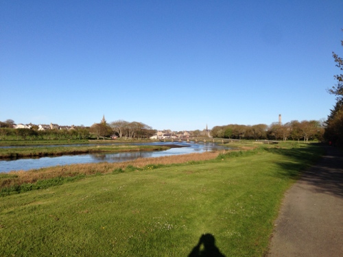
Path along river from campsite to Wick

Path along river from campsite to Wick


Outside Wick at about 23.30

Outside Wick at about 23.30


Wick by night

Wick by night

On to John o’Groats tomorrow, and then Thurso. Hope this weather continues.