07 July 2013
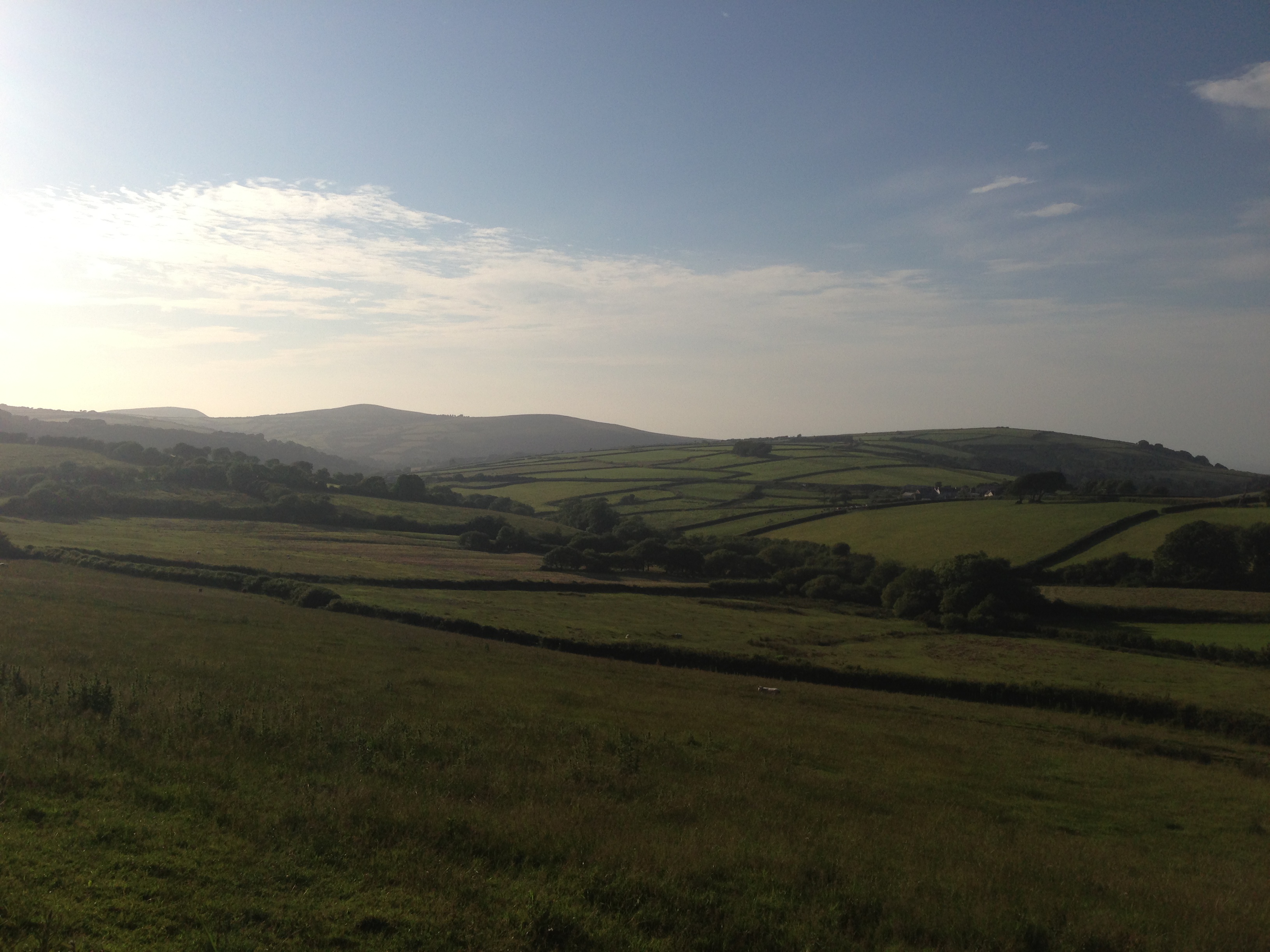
After a very chilled out evening at Sundowners I was somewhat reluctant to surface, however the heat eventually drove me from my tent into a cool northerly breeze. It looked like it was going to be another hot day for the pedal towards Land’s End.

Southwinds – another lovely day
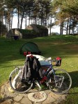
I had a shower and packed up, loading up my bike and heading back to Sundowners for breakfast. I’d been reliably informed by Matt that it would be just what I needed to get over the Cornish hills today.

Packing up again

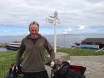
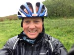
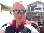
Me ready for another day, and loving the sunshine
Breakfast was large, very large. I chose the Sundowners special which consisted of 2 sausages, 2 poached eggs, bacon, beans, mushrooms, thick cut toast, and a pile of pancakes that follow a recipe Matt has perfected over a number of tasting session. The pancakes were delicious, as was the whole breakfast, although I could perhaps have squeezed in some black pudding too.

Sundowners breakfast of champions
I could have quite happily hung around the bar and Polzeath for the day, having a rest and eating more pancakes, however Land’s End was beckoning.

Perfect pile of pancakes

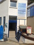
Sundowners
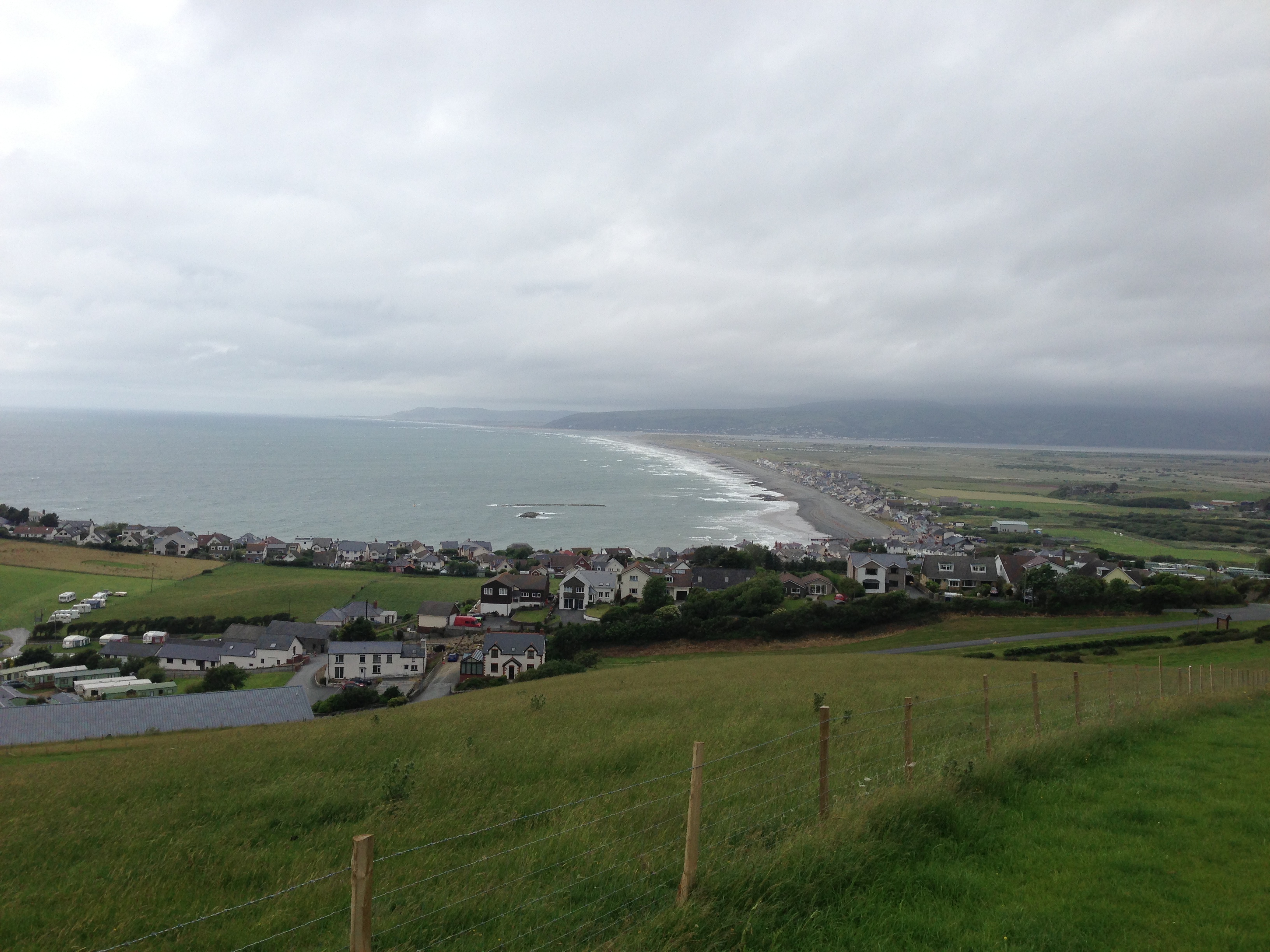
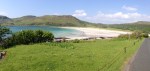
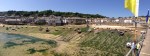
Bidding Matt and Sundowners adieu I rode down the hill to the village of Polzeath, which I still can’t pronounce right. It was very busy with beach goers, including a lot of surfers. It looked like a good day for surfing, with a decent swell.

Polzeath beach
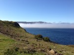
From Polzeath I cycled down down country roads, past the turning to Rock which is allegedly quite posh. I had to squeeze past several expensive cars, including a number of Chelsea tractors who showed little in the way of consideration for a laden cycle tourer, meaning I had to get friendly with the hedgerow a few times. I have a deep suspicion that a lot of people owning these huge 4x4s can’t actually cope with their size or drive them very well. When it comes to manoeuvres such as reversing, or knowing where the edges of your vehicle are on narrow roads, they panic and just sit in the middle of the lane until the person coming the other way does something. It’s quite interesting when you get one coming from either direction, with neither willing or perhaps able to get out of the other’s way. In one such situation I quickly slipped by before the stand-off got ugly.
I crossed the River Camel into Wadebridge, then rode down the Camel Trail to Padstow. It’s about 5 miles on the trail to Padstow, or Padstein as it’s often called nowadays due to the influence of the famous local chef Rick Stein.

On the Camel Trail alongside the River Camel
The popular cycle track follows the course of another old railway line, alongside the river through some lovely scenery. It being Sunday and gorgeous weather there were loads of cyclists out. You can hire bikes at either end of the trail as Nadia and Simon had done, two of my friends from Norwich, just a couple of weeks earlier. They took their son Yared on his first cycle trip down the trail, although being a baby he was only a spectator and probably slept for most of it. It was Nadia’s first outing on a bike, or a trike in this case, in a long time, and she got a puncture; should have insisted on Marathon Plus’. Well done for getting out there though!

Camel Trail – old railway bridge
I think the Camel Trail was the only flat bit of the day’s ride, however it was so packed I got caught in traffic a few times and was glad to reach Padstow.

Camel Trail – approaching Padstow
Latterly I came across two kayakers out on the river having a rather tricky time of it. They’d obviously misjudged how deep the water was going to be, and with the tide out their kayaks were grounded. There was really nothing anyone could do to help them, they were just going to have to get out and push. I left them to it hoping there was no sinking sand about.

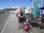
Arrival in Padstow – Stein’s fishmongers and fish and chips shop
Rick Stein has several restaurants in town, most beyond the budget of a humble cycle tourer. Lu and I had fish and chips from his shop when we visited, and whilst I was tempted to repeat the experience it was still a bit early, and I was still pretty full after my huge breakfast. Instead I had a stroll about and bought a cold drink and some flapjack, the latter for later, down by the harbour.

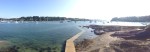
Padstow Harbour, nice boat
Padstow was really busy, thronged with holiday makers, however it was nice to pause and cool down a bit. A random passer-by stopped for a chat as I was sitting by the harbour, intrigued by what I was up to with all my panniers and slightly dishevelled appearance. We had a quick chat after which he offered me his garden to pitch up in, should I be passing at the right time of day. He lives near Exeter so it could’ve worked as I pedalled up the south coast.

Padstow Harbour

Padstow Harbour 2
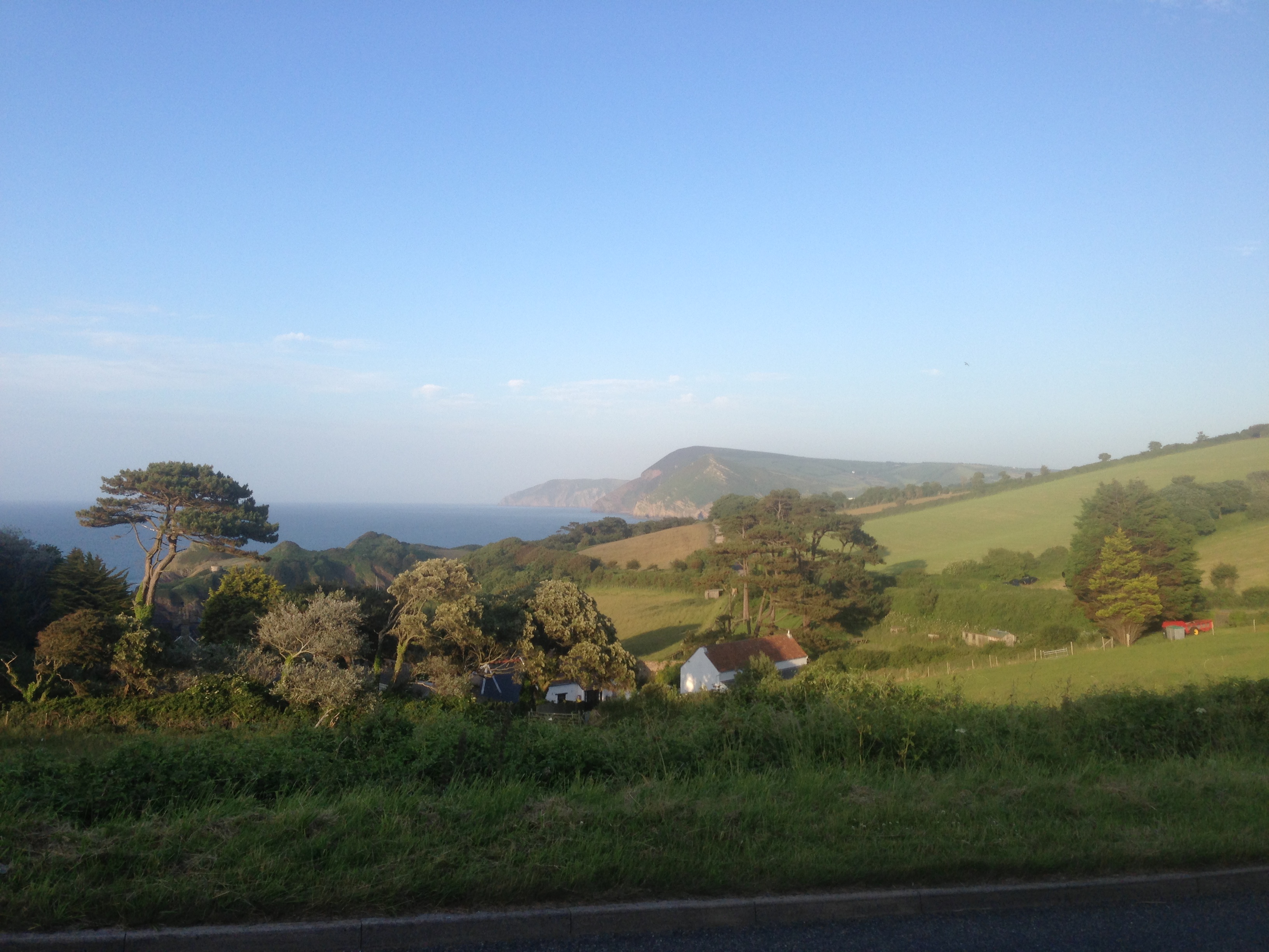
I pedalled up out of Padstow and into the Cornish hills, then down the coast to Newquay. I didn’t stop in Newquay, not wanting to get embroiled in the town. As mentioned before it’s a bit grotty these days so I continued on my way.
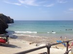
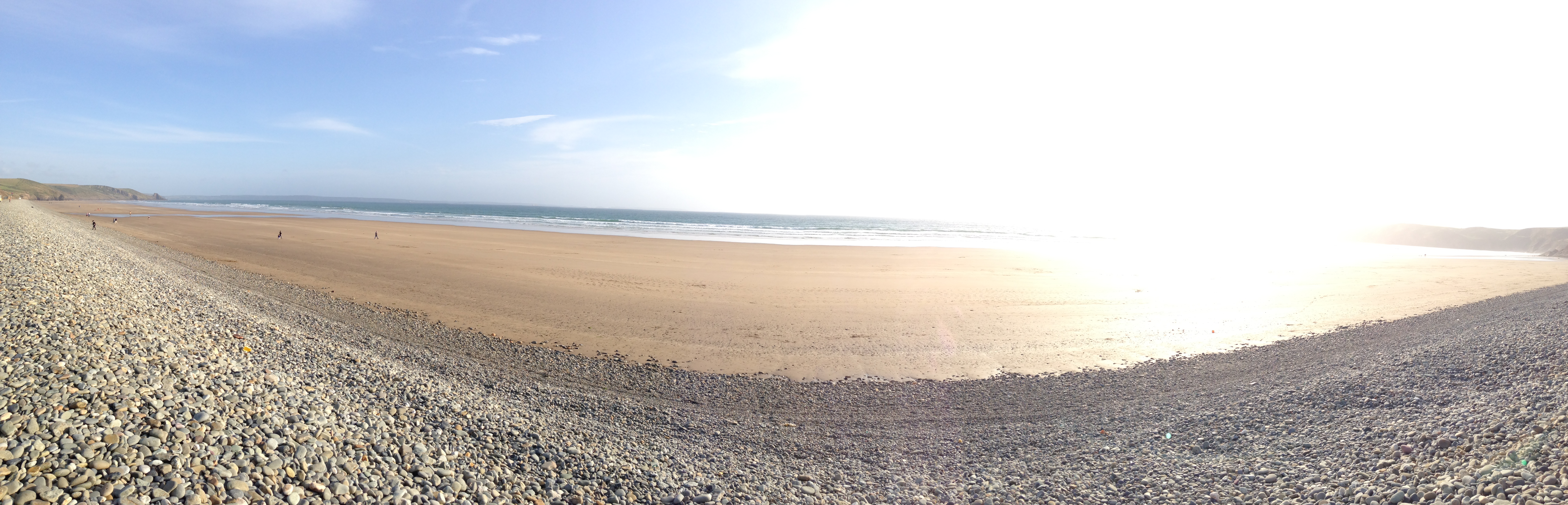
My speed today was low, perhaps averaging only 10 miles an hour due to the hills and tired legs. I was however thoroughly enjoying the ride along the north coast of Cornwall, taking in some great views and feeling in holiday mode. I rode through Perranporth passing another gorgeous and packed beach.

Perranporth 1
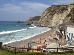
I noticed there were lots of mini tents on the beach, presumably to give people somewhere to get changed, and for infants to get some shade from the sun. Are these a new thing as I can’t remember seeing so many before? The beach was packed beach goers, either laying in the sun, surfing, playing ball games or building sandcastles, all good fun.

Perranporth 2
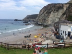
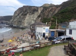
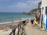
From Perranporth I rode up a steep hill and down a bit of a windy road to St. Agnes, passing through the picturesque village before reaching the cove and beach, which funnily enough was also packed with holiday makers. It’s a lovely spot and somewhere I hadn’t been before, so I decided to have a break, it being about 15.00 and well past lunchtime. I found Breakers Cafe, as recommended by Matt, and consumed a tuna melt panini with a cold drink, whilst watching the surfers and body boarders enjoying the waves.
-
- St. Agnes 1
-
- St. Agnes 2
-
- St. Agnes 3
-
- St. Agnes 4
-
- St. Agnes 5 – surf’s up
-
- Breakers Cafe, St. Agnes
-
- Me in St. Agnes
The sea looked very tempting, however I still had miles to go and didn’t want to get sand in places sand didn’t need to be – not good when cycling. Whilst it was lovely today the cove is a completely different environment during a storm, as evidenced by a picture on the wall from a few years back, which showed huge waves crashing into the cove and the front of the building. Apparently the waves were so fierce buildings were damaged and anything not tied down washed away. In fact a load of surf boards that had been tied down weren’t there any more after the storm had passed.
After refilling my empty water bottles at the cafe I was ready to go again, setting off back up the hill through St. Agnes. It was so hot today I was going through water very quickly, so the refill was well timed. The melodic strains of folk music greeted me from outside the attractive village pub, where a live band was playing; what a lovely way to spend a Sunday afternoon. The experience was repeated several times during the course of the day, with lots of bands playing in pub gardens.

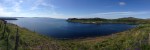
Portreath..I think
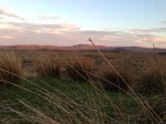
Sticking to the coast I pedalled on to Portreath, Gwithian, and then around St. Ives Bay to Hayle and St. Ives itself. My legs were really starting to ache from the constant climbs, which I seemed to spend the majority of my day tackling, the downwards stretches not taking very long.
With time ticking on I paused briefly in St. Ives to eat an energy bar (Bounce), and then set off on the B3306 to St. Just.

St. Ives
I really am going to have to get better at holding my phone straight when I’m taking pictures – another wonky horizon!
The coast road wound up and down hills along the beautiful Cornish coast, and through places familiar from childhood holidays and the more recent trip down here with Lucy. I passed a sign to Paradise Park, somewhere my brother and I had loved visiting as children. It’s a large wildlife sanctuary, with lots of tropical birds, although the we liked the birds of prey more than anything else. Good to see it’s still going strong.

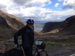
Road to St. Just
I rode through Zennor and on to Pendeen, site of the famous Geevor tin mine. Tin has been mined here for thousands of years.

Pendeen – tin mine

Geevor Tin Mine
I passed a cow by the road side. They always make me slightly nervous due to their tendency to start following me as I cycle past. I still haven’t worked out why they do this, maybe it’s my red panniers. In any case this particular bovine was fairly docile and left me alone.

Cow on the road – always makes me slightly nervous
From Pendeen it was a short ride to St. Just, where I paused to buy a few supplies for dinner. Despite it only being a couple of miles to my destination I had to have a break to try and get some energy back, drinking some chocolate milk from the Co-op, and topping up with a banana for good measure.
I finally made it over the last few hills to Trevedra Farm campsite, arriving about 20.15. Reception was closed but I’d called earlier and they’d said just to pitch up and we’d sort out paying in the morning. I got my tent up as the sun started to disappear, then settled down to the serious business of eating.

Trevedra Farm campsite
Following a large pork pie, houmous and pitta bread, fruit and chocolate, I was feeling a lot better, especially after a couple of beers. I called my parents to report that I was almost at Land’s End, and learned Andy Murray had won Wimbledon, excellent news.
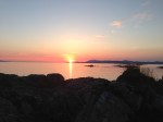
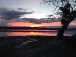
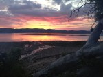
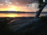
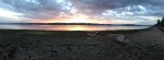
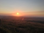
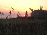
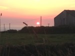
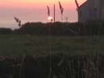
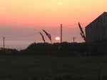
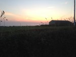
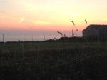
The campsite overlooks Whitesand Bay which runs around to Sennan, and I could see the Longships Lighthouse off the coast from Land’s End. I grabbed another beer and sat in the grass watching the sun go down. I was hoping to see the ‘Green Flash’, which is allegedly more visible from here. Mr Worth, the father of one of my Mum’s friends from University, fished the waters off the Cornish coast for many a year, and reported seeing it one several occasions. It’s a phenomenon only visible for a few seconds at most, as the sun sets. I didn’t see it this time around, however the sunset over the Atlantic Ocean was glorious in its own right.
-
- Trevedra Farm Sunset 1
-
- Trevedra Farm Sunset 2
-
- Trevedra Farm Sunset 3
-
- Trevedra Farm Sunset 4
-
- Trevedra Farm Sunset 5
-
- Trevedra Farm Sunset 6
It had been a good day’s ride, covering around 82 miles and bringing my total close to 4,500. The route tomorrow would take me to Land’s End, another milestone, and on to the Lizard, the most southerly point on the UK mainland. It might even be a bit flatter after today’s hills, however I wasn’t convinced. I’d got a bit sunburnt today due to sun-cream just sweating off in the heat, so would have to keep an eye on that lest I end up looking like Rudolf.
After the sun had gone down I gazed up at the stars for a bit. The sky was amazingly clear, and with little in the way of light pollution I could quite clearly see the milky way. It’s times like these when you can end up feeling remarkably small against the backdrop of the Universe.
Feeling pensive I retreated out of the north wind, which was chilling things off. I was very tired after the day’s exertions, and somewhat emotionally drained too. I kept falling asleep as I tried to write up my journal, so gave up in the end, drifting quickly off into a deep slumber.


 Mawddach")